Appearance
Release 2.4.3 (March 11, 2025)
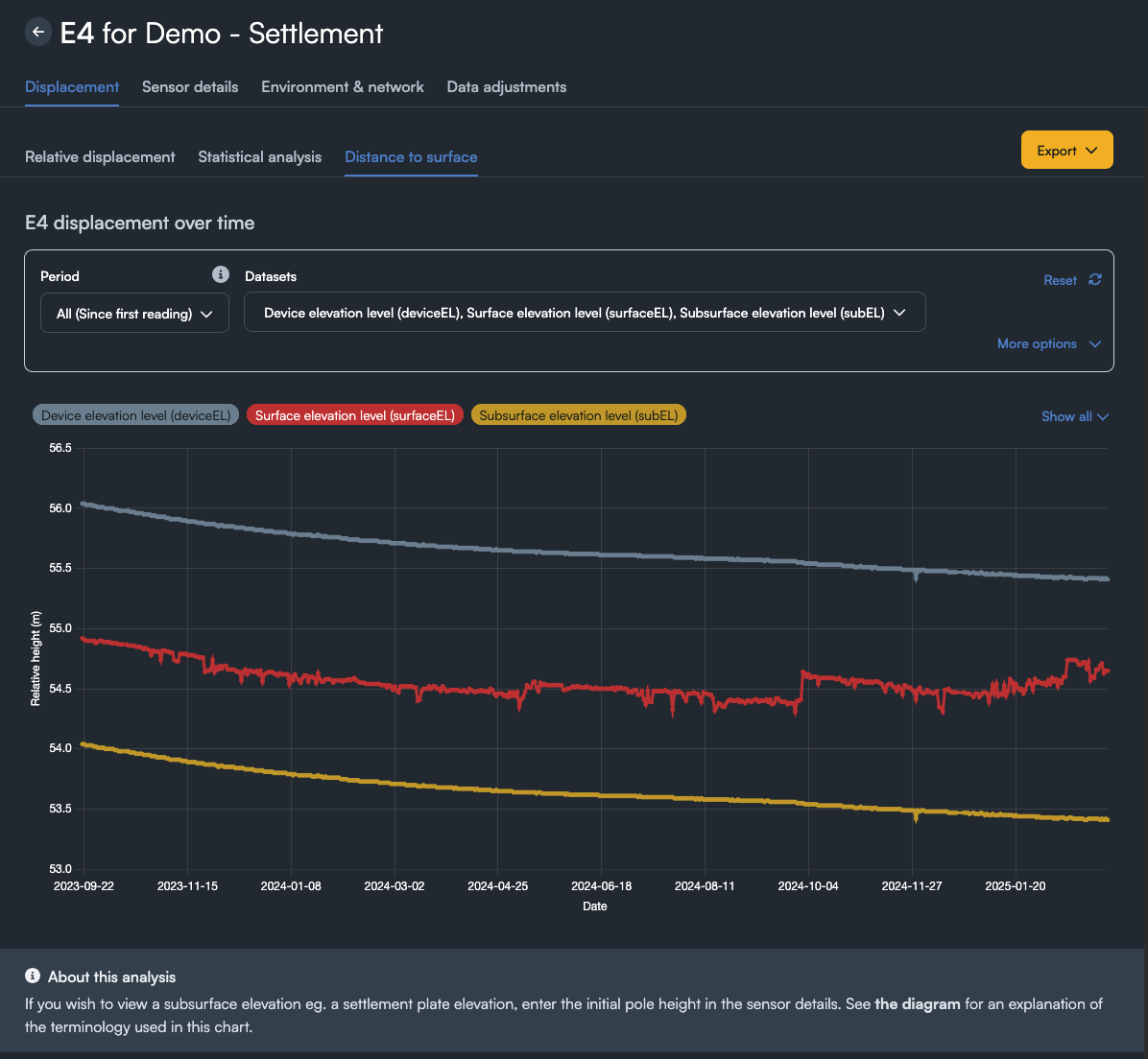
Release 2.4.3 contains improvements to the distance to surface sensor as well as clarifications about the datum used for the GNSS processing.
Distance to Surface
- Changes have been made to the distance to surface sensor display to make it more broadly available
- The terminology has been adjusted to be more generic, with the following changes:
- Ground is now refered to as surface to reflect that the measured surface is not always the ground
- Plate elevation is now called Subsurface elevation. It was initially named with settlement plates in mind, but installations other than settlement plates can be used
- References to "RL" have been replaced with elevation, since RL was misleading
- Feedback on the soil height was overwhelmingly that it was confusing so it has been removed. If the soil height is still desired, it is easily calculated using the formula:
- A project setting has been added to enable the distance to surface display for the project
- A sensor level override is also avaiable to allow only certain sensors within a project to display distance to surface.
- By default, the Device Elevation (DeviceEl) and Surface Elevation (SurfaceEL) will be shown.
- If a pole height has been provided for the sensor, the Subsurface elevation (subsurfaceEl) will also be shown.

- The data export now includes the DeviceEl, SurfaceEl, and SubsurfaceEl
Datum Clarification
- Extra detail has been added to clarify the datum that the GNSS processing engine uses for each project to ensure we are being transparent about how our results are derived
- The datum information is available in the project settings under the Preference tab, and is also in the header of export files
Bug fixes
- Auto report generation has been fixed
